
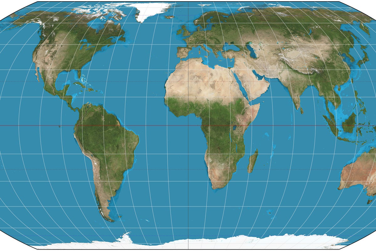
Analysis of Mercator Map Distortions and Their Influence on Geographic Perception
Recent discussions regarding Donald Trump’s interest in purchasing Greenland have highlighted the potential influence of the Mercator map projection on public perception of landmass sizes. Critics argue that this common map style distorts the true scale of countries near the poles compared to those near the equator.
The Mercator projection, a standard map used for centuries, is frequently criticized for its mathematical trade-offs. While it preserves the shapes of landmasses, it significantly inflates the size of regions further from the equator. As a result, Greenland appears roughly the same size as Africa on many classroom maps, despite Africa being approximately 14 times larger in actual land area.
Commentators have suggested that this visual distortion may contribute to misconceptions about the geopolitical and physical scale of northern territories. The discussion gained traction following reports that Donald Trump had expressed interest in the United States purchasing Greenland. Observers argue that if a leader’s perception of a territory's value or strategic importance is based on a distorted map, it could lead to flawed policy decisions. While the Mercator projection remains useful for maritime navigation due to its ability to represent lines of constant bearing as straight lines, its use for general education is increasingly debated by geographers who advocate for equal-area projections, such as the Gall-Peters map, to provide a more accurate representation of global geography.
There is no disagreement regarding the mathematical reality of the Mercator projection's distortions; however, there is debate over whether these distortions are significant enough to influence high-level political decision-making. Some analysts maintain that political leaders rely on professional briefings and satellite data rather than wall maps, while others argue that the subconscious influence of early education and common visual aids remains a powerful factor in how world leaders perceive global geography.
📡 Media Analysis
How each outlet framed the story — angles, word choices, and what they chose to push or ignore.
Used a specific political figure's actions to critique a common educational tool.
"fooled by the distorted world map"
✓ Only outlet to report: Linked the specific political interest in Greenland to the psychological impact of map projections.
⚡ Where Sources Disagree
- ·Whether political leaders are genuinely influenced by the visual scale of maps or rely solely on data-driven briefings.
🔍 What Nobody's Reporting
- ·Lack of input from cartographers regarding the intended purpose of the Mercator projection versus its misuse in general education.
- ·Absence of context regarding whether other world leaders have faced similar criticisms regarding geographic perception.
📰 Sources
0 A-rated source(s) among 1 total. Lowest trust: The Independent (B)