
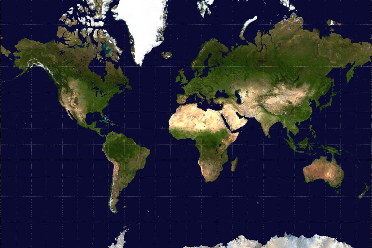
UN Adopts New World Map Standard to Address Geographic Size Distortions
The United Nations has voted to adopt a new world map projection, moving away from the traditional Mercator model. The initiative, led by African nations, aims to provide a more accurate representation of the relative landmass sizes of countries globally.
The United Nations has officially voted to adopt a new world map standard, marking a significant shift in how global geography is visualized. For centuries, the Mercator projection—which was created in 1569 for maritime navigation—has served as the primary reference for world maps. However, critics have long argued that this projection significantly distorts the size of landmasses, particularly by making regions near the poles, such as Greenland and Europe, appear much larger than they are, while shrinking landmasses near the equator, such as Africa and South America.
The initiative was spearheaded by a coalition of African nations who argued that the traditional map perpetuates outdated colonial-era biases. By adopting this new projection, the UN is encouraging governments, educational institutions, and technology companies to update their mapping software and textbooks to reflect the true relative sizes of all countries. Proponents of the change suggest that this move is essential for fostering a more equitable global perspective, as the Mercator projection has been criticized for diminishing the visual importance of the Global South.
While the transition is expected to be gradual, the UN's endorsement provides a formal framework for the shift. Tech firms and publishers are now being urged to integrate these more accurate projections into their digital platforms and educational materials. The move has been welcomed by geographers who have advocated for years for a more scientifically accurate representation of the Earth's surface, though some logistical challenges remain regarding the widespread replacement of existing physical and digital mapping infrastructure.
📡 Media Analysis
How each outlet framed the story — angles, word choices, and what they chose to push or ignore.
Framed the map change as a necessary correction to historical and colonial geographic bias.
"true size of all countries"
✓ Only outlet to report: Identified that the campaign was specifically led by African nations.
🔍 What Nobody's Reporting
- ·Lack of comment or perspective from nations that benefit from or prefer the Mercator projection.
- ·No discussion of the technical or financial costs associated with updating global mapping infrastructure.
📰 Sources
0 A-rated source(s) among 1 total. Lowest trust: The Independent (B)