
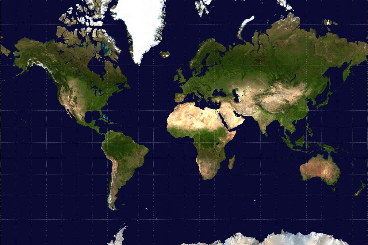
UN Backs Initiative to Adopt New World Map Projection
The United Nations has voted to support a campaign advocating for the use of map projections that more accurately represent the landmass of Africa. The initiative encourages schools, governments, and technology companies to move away from the traditional Mercator projection.
A new initiative backed by a United Nations vote is pushing for a global shift in how the world is visualized on maps. The campaign, led by African nations, argues that the long-standing Mercator projection—the standard map used in most classrooms and digital platforms—significantly distorts the size of continents. Specifically, critics of the Mercator model point out that it makes Africa appear much smaller than it is in reality, while exaggerating the size of landmasses in the Northern Hemisphere.
The movement is calling on governments, educational institutions, and major technology firms to adopt alternative projections that provide a more accurate representation of geographic scale. Proponents of the change argue that the Mercator projection, which was created in the 16th century for maritime navigation, carries colonial-era biases that misinform the public about global geography. By shifting to more accurate models, such as the Gall-Peters projection, supporters believe the international community can foster a more equitable understanding of the world’s physical dimensions.
While the UN vote marks a significant symbolic victory for the campaign, the practical implementation remains voluntary. There is no binding requirement for private tech companies or national school systems to change their maps, meaning the transition will likely depend on individual adoption by organizations and software developers. The move is part of a broader ongoing discussion regarding how historical cartography influences modern perceptions of global importance and geopolitical power.
📡 Media Analysis
How each outlet framed the story — angles, word choices, and what they chose to push or ignore.
Framed the map change as a necessary correction to historical colonial bias.
"true size of Africa"
🔍 What Nobody's Reporting
- ·Lack of perspective from cartographers regarding the trade-offs between size accuracy and shape distortion in map projections.
- ·No mention of the potential costs or technical challenges for tech companies to update global mapping software.
📰 Sources
0 A-rated source(s) among 1 total. Lowest trust: The Independent (B)